
1. Loss of Low-Lying Island Nations
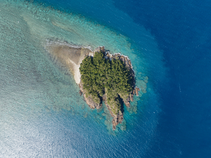
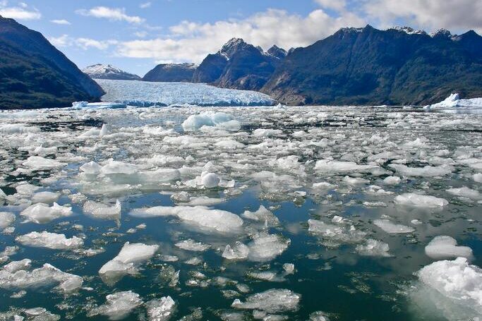
As global temperatures climb, our planet’s colossal ice reserves are yielding their water, setting in motion a slow, undeniable reshaping of coasts and a dramatic shift in human geography. Many small island developing states (SIDS), particularly low-lying coral atolls like Kiribati and the Maldives, face complete submersion. These nations have an average elevation of just a few feet above sea level, making them some of the most vulnerable places on Earth. As the water inches higher, saltwater intrusion contaminates their already limited freshwater reserves, making the islands uninhabitable even before they are fully submerged, forcing entire populations to seek refuge elsewhere and dissolving the geographic existence of sovereign states.
2. The Sinking of Coastal Megacities
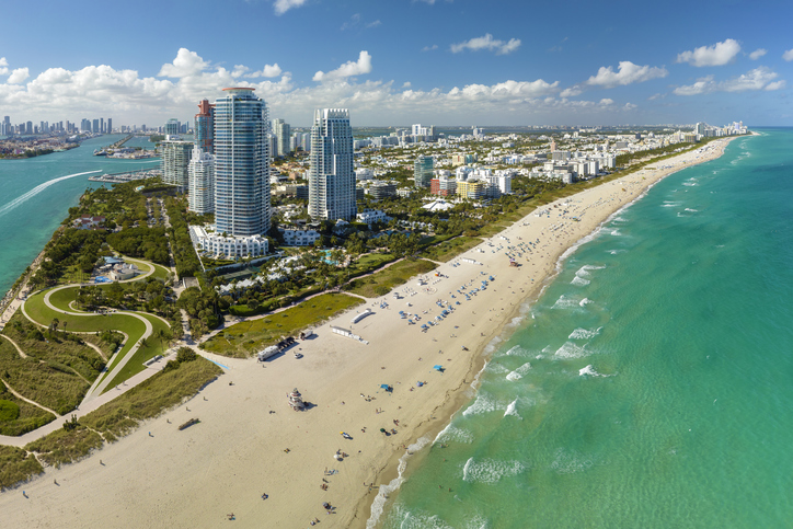
Global hubs like Miami, Shanghai, Lagos, and Bangkok are built on flat, low-lying coastal land and are directly in the path of rising tides. In places like Jakarta, this threat is compounded by aggressive groundwater pumping causing the land to sink (subsidence) at an alarming rate, sometimes by several inches per year. A rise of just a few feet this century will push storm surges much farther inland, leading to catastrophic, perennial flooding that will eventually necessitate massive, costly flood defenses or force the abandonment of some of the world’s most economically vital urban centers.
3. Saltwater Invades Farmland
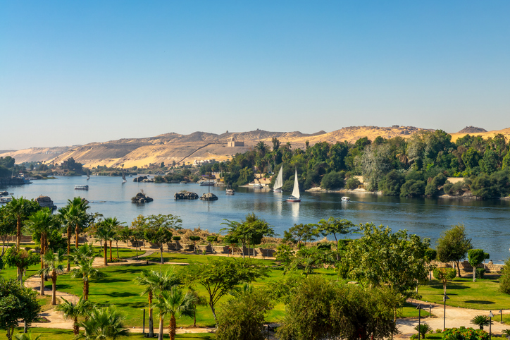
The flat, fertile land of major river deltas, such as the Nile in Egypt, the Ganges in Bangladesh, and the Mekong in Vietnam, is being poisoned by saltwater intrusion. As sea levels rise, the salty ocean water pushes further up rivers and into coastal aquifers. This renders vast tracts of once-productive agricultural land unusable for crops that are intolerant to high salinity, directly threatening the food security of millions of people who rely on these “rice bowls” for sustenance and creating new land-use boundaries.
4. The Disappearance of Venice and the Netherlands’ Battle
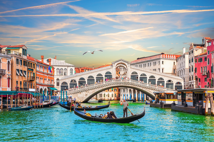
Iconic European lowlands face existential threats. Venice, Italy, already experiences regular acqua alta (high water) that floods its historic squares and buildings, but rising seas will make such flooding permanent. Meanwhile, the Netherlands, much of which is already below sea level and protected by sophisticated dikes, will have to spend trillions on ever-higher and stronger defenses. The battle to hold back the North Sea will become a defining and incredibly expensive national project, potentially limiting habitable land and economic activity.
5. Arctic Sea Ice Retreat Opens New Shipping Routes
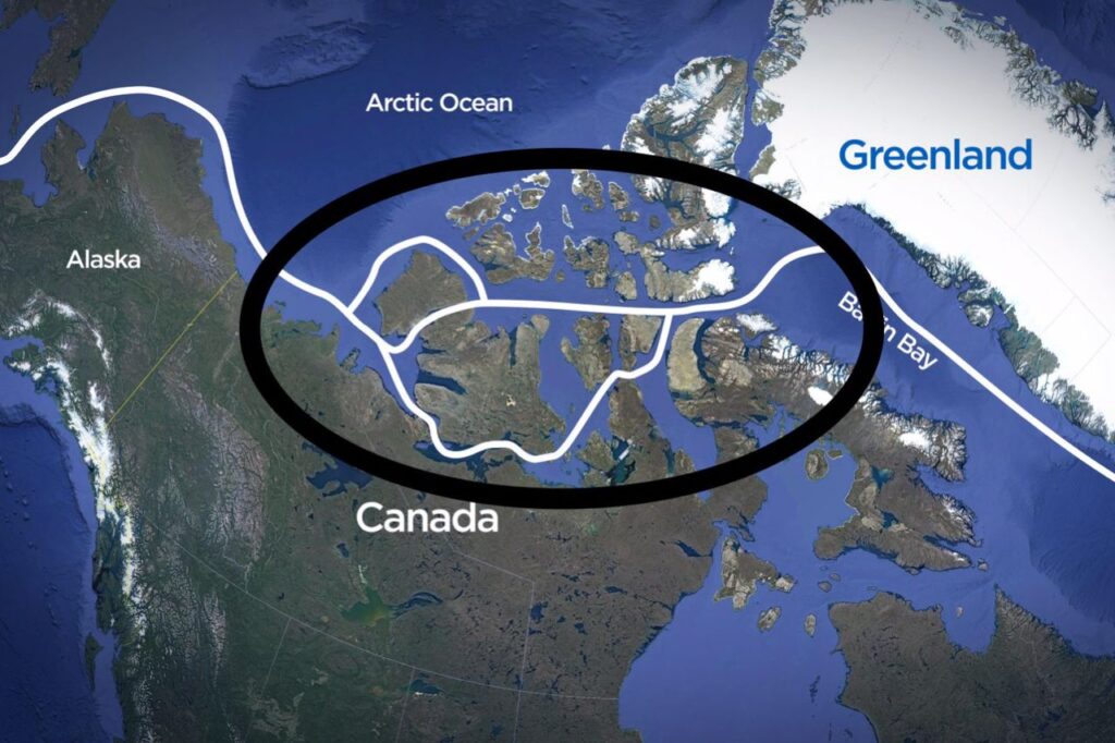
While not directly caused by meltwater, the loss of summer sea ice in the Arctic Ocean, which is largely floating and does not contribute to sea level rise, dramatically redraws trade maps. The famed Northwest Passage and Northern Sea Route are becoming navigable for longer periods each year. This could slash shipping times and costs between Asia, Europe, and North America, opening new economic frontiers but also creating new geopolitical flashpoints as nations compete for access and resources in the newly accessible polar region.
6. Massive Displacement and Climate Migration
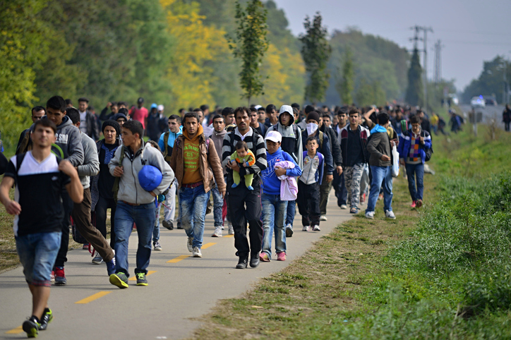
The cumulative effect of losing coastal land and vital resources will trigger the largest forced migration in human history. Estimates suggest hundreds of millions of people could be displaced, moving inland and to higher ground. This rapid, large-scale shift of populations will create new political, social, and infrastructure crises in receiving areas, effectively redrawing not geographical borders but human distribution maps, placing immense pressure on land-use, resources, and international aid systems.
7. Erosion of Coastal Cultural Heritage
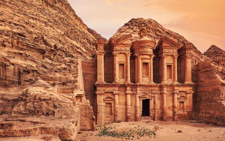
Sea level rise will destroy ancient archaeological sites, historical monuments, and sacred coastal burial grounds across the globe. Low-lying coastal shell middens left by Native American communities in places like Florida are already being eroded by storms and rising tides. Cities with rich maritime histories will see their oldest seafront structures crumble. This loss is a permanent erasure of human history and cultural identity, redrawing the map of human memory and heritage.
8. Freshwater Contamination of Aquifers
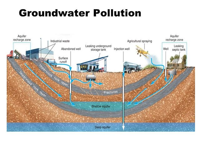
Many coastal communities, particularly those in drought-prone regions, rely on underground freshwater aquifers for drinking and agriculture. As sea levels rise, the pressure of the denser saltwater causes it to seep into these porous rock layers, contaminating the freshwater supply. This renders the land unusable for human settlement or agriculture until new, often more distant and expensive, water sources can be secured, creating new limits on inland settlement patterns.
9. Shifting National Maritime Boundaries
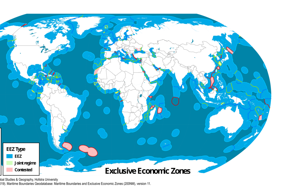
International maritime law, including Exclusive Economic Zones (EEZs), is largely based on the location of coastlines and baselines. As coastlines erode or low-lying islands disappear entirely, the legal basis for these boundaries shifts, potentially eliminating or drastically shrinking the EEZs of affected nations. This could lead to complex international disputes over fishing rights, seabed resources, and offshore oil and gas reserves, literally redrawing the map of economic and sovereign control over the ocean.
10. Loss of Protective Coastal Wetlands and Marshes
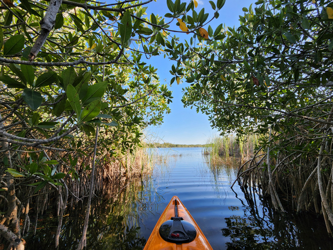
Coastal wetlands, mangroves, and salt marshes are natural buffers that absorb storm surge energy and prevent inland flooding. As sea levels rise, these ecosystems are often unable to migrate inland quickly enough due to human development blocking their path. Their loss weakens the natural defense of the coast, accelerating erosion and making inland areas more vulnerable to storms and high tides, essentially pushing the geographical danger zone further inland than the new water line itself.
11. Exposing Buried Toxic Waste and Landfills
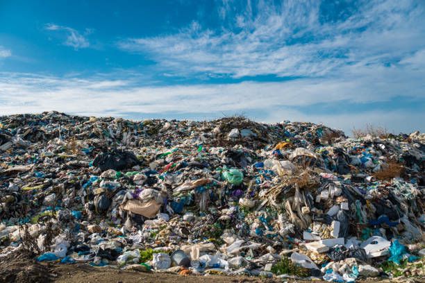
Many low-lying coastal areas contain old, sometimes unregulated, landfills and toxic waste sites. As these areas flood, the rising waters will breach the containment of these sites, washing hazardous materials, chemicals, and pollutants into the marine environment and onto nearby land. This creates vast new zones of environmental contamination, rendering certain coastal areas permanently toxic and unsuitable for human or ecological habitation, thereby enforcing an undesirable “no-go” zone on the map.
12. The Creation of New “Sea” Lakes
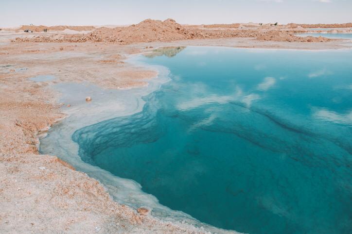
In some extremely flat coastal regions, rising sea levels will not simply submerge the land but will flow into low-lying basins and depressions, creating large, shallow, permanent saltwater lakes or lagoons many miles from the original coastline. This transformation of terrestrial geography into new bodies of water will create completely novel coastal ecosystems and change local microclimates, significantly altering local maps and land ownership.
13. Increased Land Subsidence from Drainage
To cope with initial increases in high-tide flooding, many coastal cities attempt to drain water more aggressively, often through extensive pumping and channeling. Ironically, removing water from the soil layers beneath the city can cause the land to compact and sink faster, a process known as induced subsidence. This counterproductive cycle accelerates the city’s vulnerability to sea level rise, turning temporary flooding into a permanent problem much sooner than models based only on global sea level rise would predict.
14. The Thawing of Permafrost in Siberia and Alaska
While mostly an Arctic land issue, the thawing of vast stretches of permafrost (permanently frozen ground) in Siberia, Alaska, and Canada has significant geographic and sea level implications. The thawing releases enormous amounts of potent greenhouse gases like methane, accelerating global warming and, therefore, ice melt everywhere. Geographically, it destabilizes coastlines, infrastructure, and roads, leading to massive slumping and erosion that essentially disintegrates the existing coastal map in these northern regions.
15. Shifting River Mouths and Sedimentation
River deltas are dynamic systems where land is built by sediment deposited by the river. As sea levels rise, the force of the river current is less able to push its sediment load out to sea, causing more of it to drop prematurely. This alters the shape of the river mouth, potentially clogging existing navigation channels while simultaneously allowing the ocean to push its way further inland, transforming estuarine ecology and requiring the constant re-mapping of vital waterways for commerce.
16. Altered Global Ocean Circulation Patterns
The melting of the Greenland Ice Sheet releases massive quantities of cold, fresh water into the North Atlantic. This influx of less-dense water can disrupt the Atlantic Meridional Overturning Circulation (AMOC), the key driver of the Gulf Stream. A weakening of the AMOC could lead to localized sea level increases on the Eastern seaboard of North America and Western Europe, and dramatically alter weather and temperature maps across the North Atlantic, making some areas unexpectedly cooler and others more flood-prone.
17. Expansion of Coastal Barrier Islands
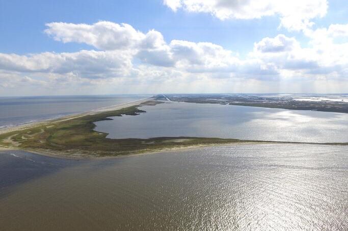
Barrier islands are long, narrow strips of sand that parallel the mainland and naturally migrate landward in response to sea level rise. However, with accelerated sea level rise, the rate of migration may outpace their ability to rebuild, leading to their complete overwash and destruction. This loss of the first line of natural defense would expose the mainland to the full, devastating force of ocean storms, fundamentally redrawing the functional coastal map to one with far fewer natural buffers.
18. Increased Seismicity from Ice Load Removal
The weight of the massive ice sheets in Greenland and Antarctica is enormous. When this ice melts, the colossal weight is removed from the Earth’s crust, which then slowly rebounds, a process called glacial isostatic adjustment. This change in pressure can trigger or intensify seismic and volcanic activity in glaciated regions, creating new instability in the Earth’s crust and potentially adding unexpected new features or hazards to the geological map.
19. Redefining Coastal Infrastructure and Engineering
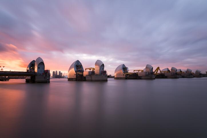
Rising seas and increased flooding force coastal cities to fundamentally rethink and rebuild their infrastructure. Seawalls, levies, surge barriers (like the Thames Barrier in London), and raised roads become ubiquitous. The map of an affected city becomes defined by these engineering structures, prioritizing high-value districts and creating socio-economic divisions where access and safety depend on expensive, elevated infrastructure, thus creating a new, engineered coastline.
20. Permanent Inundation of Ports and Harbors

Global trade relies on coastal ports and harbors, many of which are situated at low elevations for ease of access and dredging. Rising sea levels will permanently flood key operational areas, necessitating the abandonment or incredibly expensive elevation of piers, cargo handling facilities, and essential railway links. The shift of vital port operations to higher ground will redraw the economic geography of maritime trade, favoring regions with naturally higher shorelines.
21. New Access to Previously Frozen Terrestrial Resources
As glaciers and ice caps retreat on land, they uncover areas that have been frozen for millennia, revealing new deposits of minerals and metals. This creates a geographic rush for newly accessible mining sites in mountainous and polar regions. The pursuit of these previously hidden resources will dramatically alter the land-use map in these remote areas, leading to new infrastructure development like roads, pipelines, and settlements.
22. Loss of Key Coastal Defense Military Bases
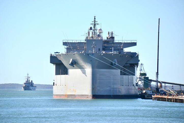
Many of the world’s most strategic naval bases and military installations are located directly on the coast. As sea level rise and coastal erosion intensify, these facilities face functional and structural compromise from recurrent flooding. The need to relocate or heavily fortify these highly specialized, critical sites will force a redraw of national defense planning and military geography, potentially shifting major strategic assets far inland.
The changes ahead are not abstract; they are already in motion, gradually yet powerfully redefining coastlines, threatening ancient cities, and altering the very fabric of human civilization. It’s a stark reminder that geography is never truly fixed, and our collective actions today will determine the shape of the world map tomorrow.
This story 22 Shocking Ways Melting Ice and Rising Season Could Redraw the World Map was first published on Daily FETCH


