
Baffling stories of unfound shores

Islands have long fascinated explorers and mapmakers, but some islands have mysteriously vanished from maps, leaving behind tales of intrigue and natural wonder. Here’s a list of eight islands that disappeared without a trace, each with its own unique story.
1. The Lost Island of Bermeja
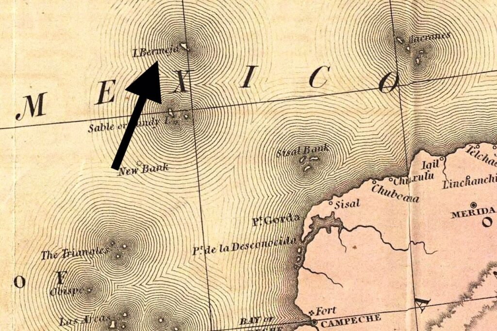
Isla Bermeja was once marked on maps in the Gulf of Mexico (North of the Yucatan Peninsula, Mexico). It was first mentioned on maps in the 16th century, with some sources suggesting it was discovered by Spanish explorers in the 1500s, and believed to be a valuable reference point for territorial waters. However, by the late 20th century, explorers and satellites could find no trace of it. Some theories suggest it sank due to natural subsidence or was a cartographic error, but its disappearance has complicated maritime boundaries and sparked speculation about the real truth about phantom Islands in general. Source: geographyrealm.com
2. Sandy Island, South Pacific
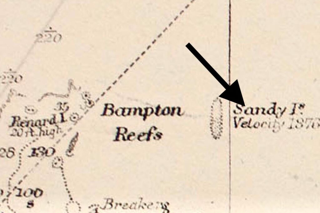
Sandy Island, also known as Sable Island or Ile de Sable is a phantom island that appeared on maps and nautical charts for over a century near New Caledonia, in the coral sea of northeast of Australia. The island was first recorded by the whaling ship Velocity in 1876 and first appeared on a British Admiralty chart in 1908. However, the French Hydrographic Service officially removed Sandy Island from its nautical charts in 1974, and further confirmation of its non-existence was made in 2012 by Australian scientists aboard the R/V Southern Surveyor. It turned out to be a phantom island, likely a mapping mistake perpetuated by earlier explorers, highlighting how errors can persist in cartography for decades. Source: en.wikipedia.org
3. The Island of Buss
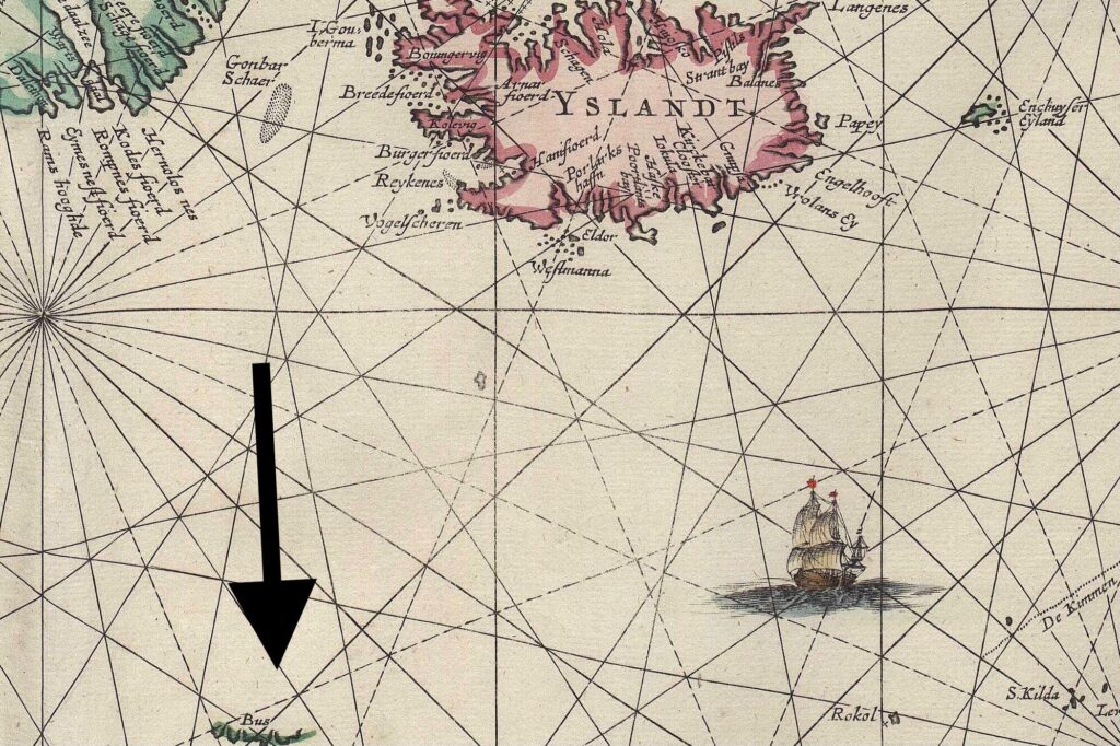
Located in the North Atlantic, Bus or Buss Island was reported by 16th century explorers including Martin Frobisher’s fleet during his search for the northwest passage. This island was said to be located between Greenland and Iceland around 57°30’N 47°00’W. But later expeditions organised to locate the area failed to find it. It was thought to be a fog bank or iceberg mistaken for land. Regardless, its presence on maps influenced navigation routes before being officially removed. This shows how early exploration could mistake natural phenomena for landmasses. Source: Irishexaminer.com
4. Saxemberg Island
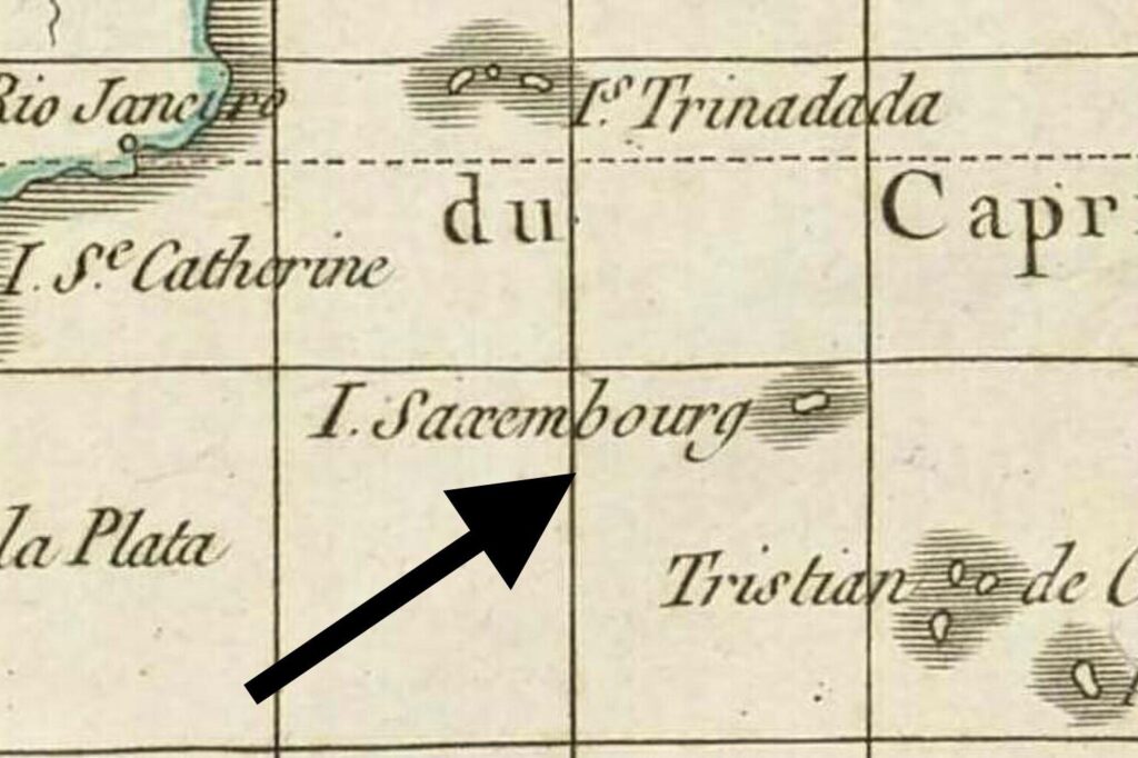
Saxemberg Island, also known as Saxemburg or Saxembourg, was charted in the South Atlantic between the 17th and 19th centuries by Dutch seafarer John Lindestz Lindeman. He also made a sketch in which he depicted the island as “low lying”, but this claims suddenly vanished from subsequent surveys. Some speculate it was a volcanic island that eroded or submerged, while others think it was a navigational error. Its disappearance, however , remains a mystery, reflecting the challenges of early oceanic exploration at a time of little technology and knowledge of the sea. Source: en.wikipedia.org
5. Emerald Island
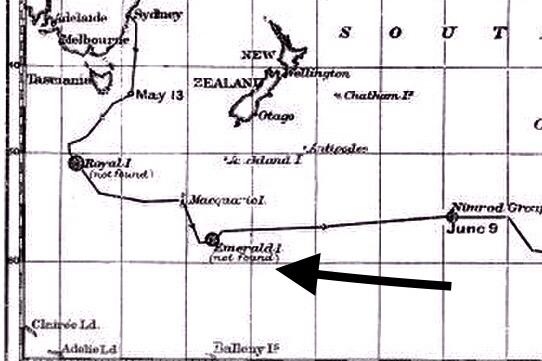
Emerald Island was reported to be located at the Southern Ocean near Antarctica in 1821 (at geographical coordinates 57°30′S 162°12′E) by a Captain William Elliot of the British sealing ship Emerald who claimed it was “small and mountainous”. But it was never confirmed by the U.S explorers in the 1840s. The island continued to appear on maps until 1987, with some historians attributing the sighting to a Fata Morgana or mirage. Historians believed it to have been an optical illusion caused by icebergs or mirages, another case of natural mishap on how harsh environments can trick even experienced sailors. The area is now referred to as Emerald Basin, an abyssal plain, with no evidence of the island’s existence. Source: en.wikipedia.org
6. Dougherty Island
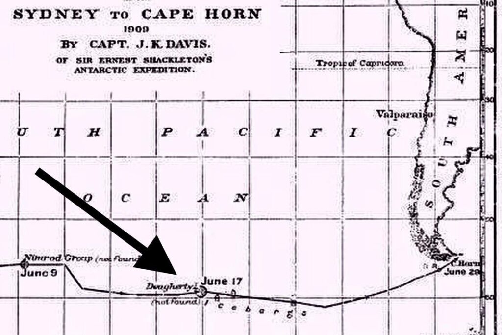
Dougherty Island is a phantom island reportedly located in the southern Pacific Ocean. It was supposedly discovered in 1841 by several ships, including one captained by Dougherty. However, despite numerous attempts, no one has been able to find the island since its initial reported sighting. The island was said to be located around 59°20′S 120°20′W, but its existence has never been confirmed. The island’s reported existence might be due to navigational errors, misidentification of icebergs or other geographical features, or even deliberate fabrication. Even though Dougherty Island was included on some historical maps, but it has been largely removed from modern maps due to the lack of evidence supporting its existence.
7. Thompson Island
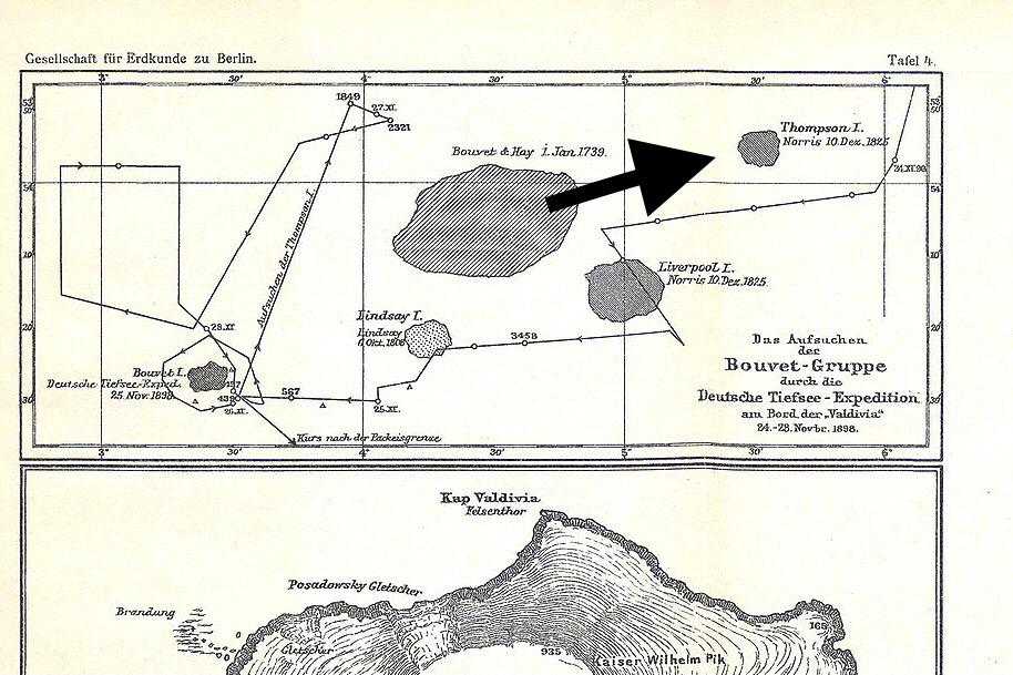
Thompson Island, or Thompson Phantom Island, is a phantom island reportedly located in the South Atlantic Ocean. According to historical records, it’s believed to be about 70-150 km north-northeast of Bouvet Island, a Norwegian dependency between South Africa and Antarctica. In 1825, George Norris, a ship captain, claimed to have spotted the island, which was subsequently included on some maps. Despite numerous attempts, no one has been able to verify the island’s existence, leading to its classification as a phantom island.
8. Royal Company’s Islands
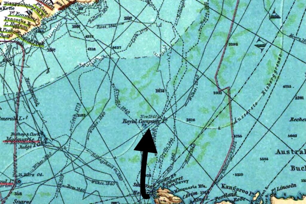
The Royal Company’s Islands are a group of phantom islands that were reportedly located southwest of Tasmania. These islands were first mentioned before 1840, but the original report can’t be traced. Many old charts showed them at specific coordinates: 50°20′S 140°0′E or 52°20′S 143°0′E. After unyielding search, The United States Exploring Expedition disproved their existence as early as 1840. Also, further searches by several vessels, including the Antarctic in 1894, the Nimrod in 1909, and the Aurora in 1912, failed to find any evidence of the islands. By 1904, the UK Hydrographic Office removed the islands from all Admiralty charts due to lack of evidence.
These vanished islands remind us that maps are human interpretations subject to change with new knowledge and technology. They also inspire curiosity about what lies on earth, beneath the oceans and how our understanding of the world evolves. If you enjoyed exploring these mysterious lost islands, keep up with our stories to uncover more fascinating tales from the world’s oceans.


