
In a world where you can find anything with a click or swipe, it’s hard to believe some places still remain out of reach. But these remote corners of Earth have done the unthinkable: they’ve slipped past even the all-seeing eyes of Google Maps. These aren’t just travel challenges, they’re wild, isolated mysteries that refuse to be pinned down. Curious? You’re about to explore the places that tech gave up on.
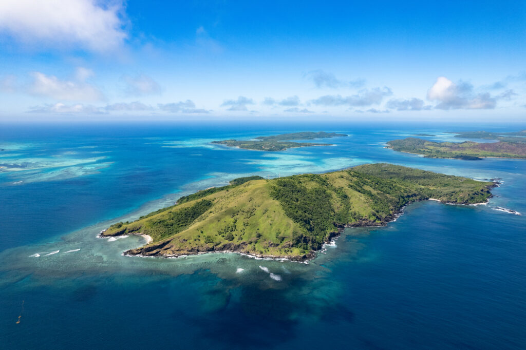
1. North Sentinel Island, India

Tucked deep in the Bay of Bengal, North Sentinel Island isn’t just remote, it’s off-limits. The indigenous Sentinelese people have rejected all outside contact, and the Indian government enforces a no-go zone to protect both the tribe and outsiders. This means Google can’t map roads, structures, or even terrain details. Experts agree that the combination of legal restrictions, ethical concerns, and natural isolation make this one of the most enigmatic places on Earth, digitally and physically invisible. Source: aviationfile.com
2. Pitcairn Island, Pacific Ocean

This speck of land, home to descendants of the infamous HMS Bounty mutineers, is technically part of the UK but getting there is a mission. With no airport and only infrequent boat access, even satellite imaging has trouble keeping track. Google Maps can show you the general location, but street view? Forget it. Analysts say Pitcairn’s remoteness, harsh weather, and lack of digital infrastructure keep it largely hidden from the virtual world. Source: The Pitcairn Islands
3. Gangkhar Puensum, Bhutan

At over 24,000 feet, this majestic Himalayan peak holds a strange title: the world’s highest unclimbed mountain. Out of respect for spiritual beliefs and safety concerns, Bhutan banned climbing here, and as a result, mapping efforts are sparse. Google’s tools struggle to gather data in such extreme, sacred terrain. Mapping experts admit that when technology meets tradition and topography this intense, it’s no surprise the mountain remains a digital mystery. Source: Highest unclimbed mountain
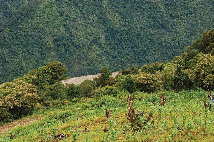
4. Vale do Javari, Brazil
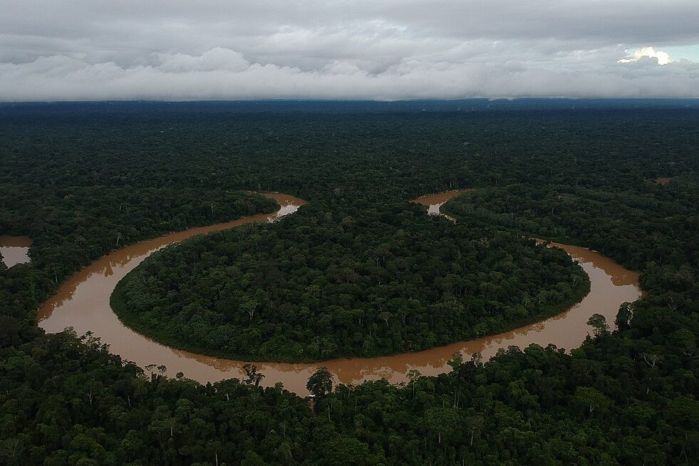
Deep in the Amazon Rainforest lies Vale do Javari, a region home to the largest concentration of uncontacted tribes in the world. Not only is this area politically and ethically protected, but the dense, ever-changing jungle also makes mapping a nightmare. Google’s satellite views are blurry at best, and ground-level data is nonexistent. Environmental specialists note that the area’s ecological complexity and cultural sensitivity make digital tracking nearly impossible. Source: news.mongabay.com
5. Svalbard Global Seed Vault, Norway
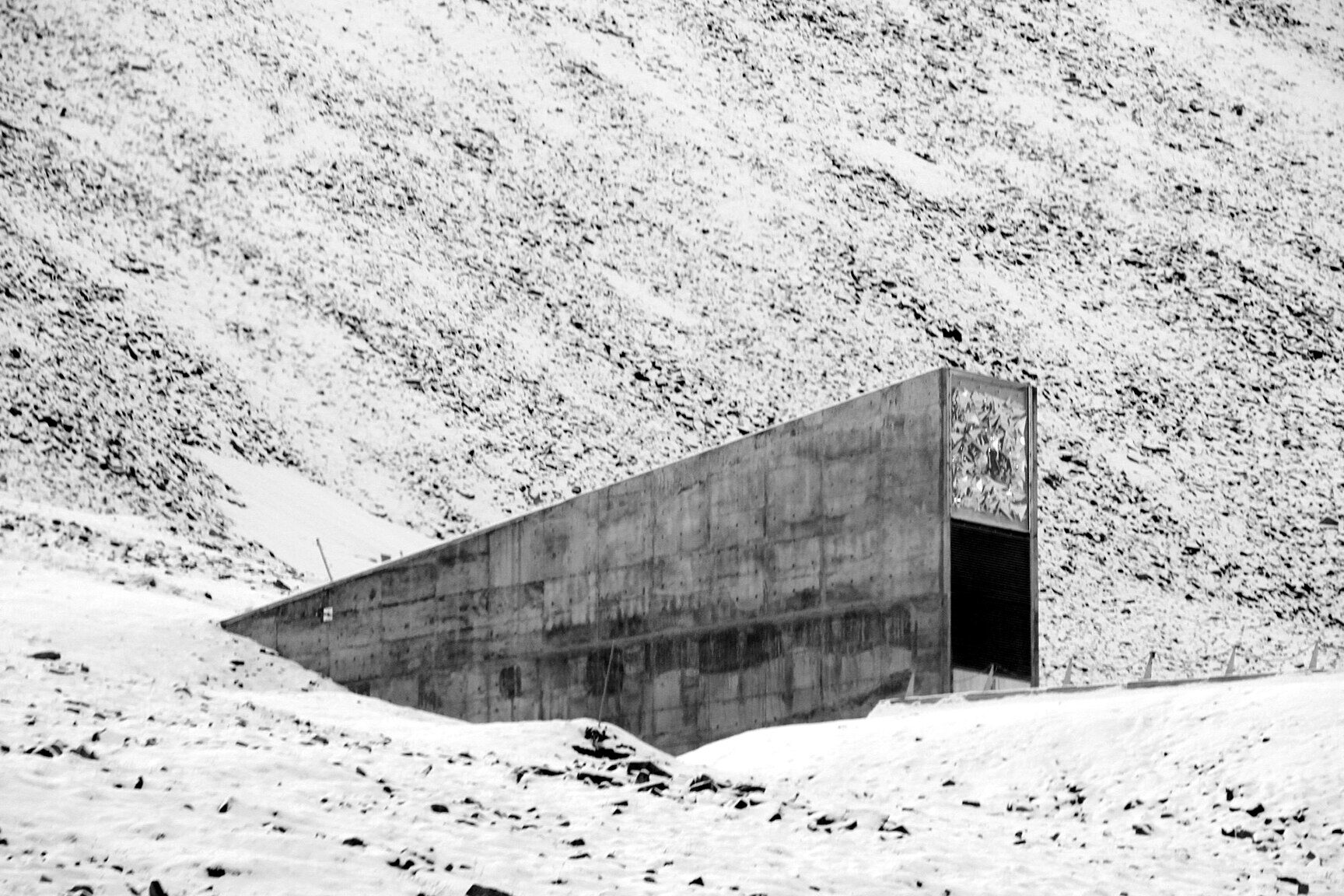
Buried inside a mountain on an Arctic island, this doomsday vault is more fortress than facility. It stores the world’s backup supply of seeds in case of global catastrophe. While Google Maps shows its outer structure, anything beyond that is tightly secured and classified. Security analysts say the remote location, subzero environment, and controlled access protocols intentionally keep the vault off the digital grid—and for good reason.
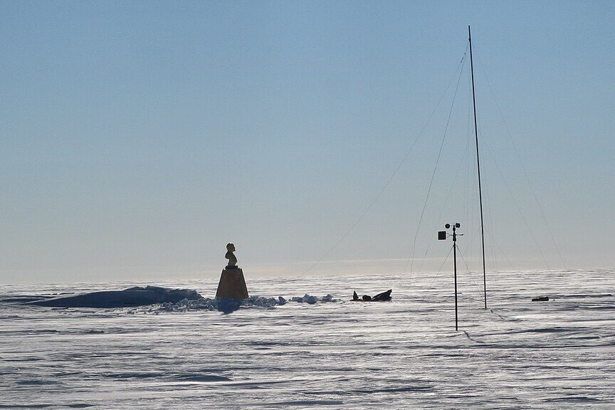
6. McMurdo Dry Valleys, Antarctica

Unlike the rest of Antarctica’s snow-covered landscape, the Dry Valleys are eerily barren. This hyper-arid region is one of the closest terrestrial matches to Mars, and it’s so harsh that barely any life survives. Google can capture satellite images, but there’s no usable street data or high-res detail. Scientists point out that the extreme weather, poor internet access, and limited human presence make digital mapping virtually useless here.
7. Area 51, Nevada, USA
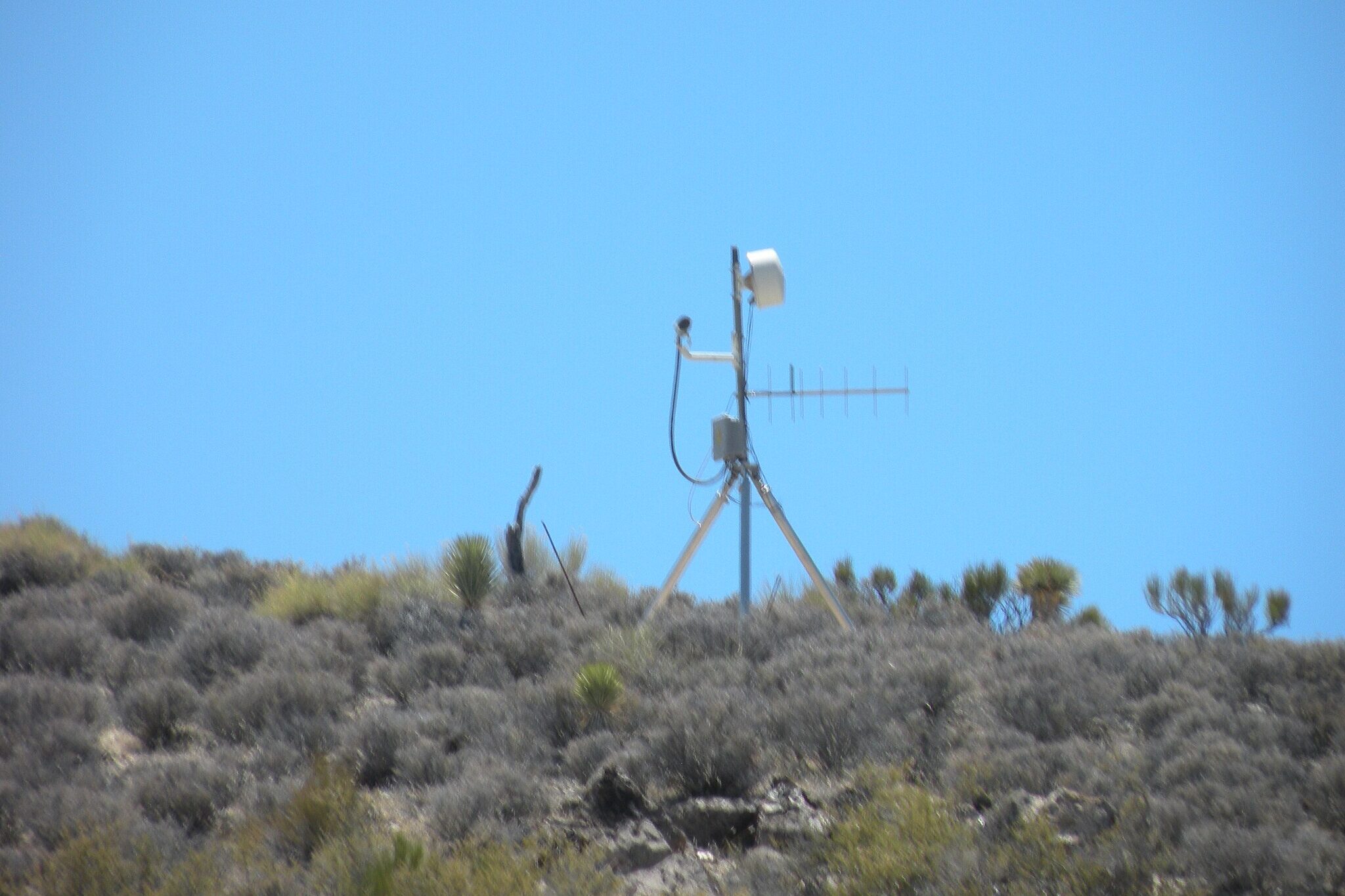
We couldn’t make a list like this without including the world’s favorite conspiracy magnet. Located in the Nevada desert, Area 51’s exact activities remain classified. While Google Maps technically shows a blurred aerial image, everything else is hush-hush. Military and tech experts explain that this secrecy is entirely intentional, meant to protect national security projects. It’s not just remote—it’s digitally redacted.
8. Point Nemo, Pacific Ocean
This isn’t land, but it deserves a spot here. Point Nemo is the oceanic pole of inaccessibility, the farthest point from any land on Earth. It’s so isolated, the nearest humans are often astronauts passing overhead in the International Space Station. Google Maps can drop a pin, but there’s no imagery, detail, or navigation info to provide. Oceanographers say the vast, featureless expanse makes traditional mapping methods completely ineffective.
9. Motuo County, China
Often called the last hidden place in Tibet, Motuo remained without road access until just a few years ago. Even now, landslides and extreme terrain frequently cut it off from the rest of the country. The region’s isolation, combined with strict governmental controls, makes digital access difficult. Google’s tools are limited here, and experts say that mapping the area requires navigating political, geographical, and technological barriers all at once.
10. The Tsingy de Bemaraha, Madagascar

With razor-sharp limestone formations so dense and deadly, this UNESCO World Heritage site is a literal labyrinth. Walking here requires harnesses and ropes—so don’t expect a nice panoramic view on Google Maps. Its name means “where one cannot walk barefoot,” and even drones struggle to capture useful imagery. Geologists and conservationists agree: the terrain is too complex and dangerous to map effectively, which keeps this natural wonder cloaked in digital obscurity.
Know a hidden gem or a secret spot that even Google missed? Share your thoughts in the comments and tell us what’s the most off-the-map place you’ve ever visited or dreamed of seeing? Let’s swap stories and uncover the world’s best-kept secrets together.


