
1. Winters That Shape Where People Stay

If you ever wondered why such a huge stretch of northern land holds so few Americans, the answer often starts with something simple and very human. Weather decides more about daily life than most maps show. In many northern interior regions, winter is not just cold for a few weeks. It stretches long enough to affect school schedules, work commutes, construction plans, and even grocery deliveries. Snow removal becomes routine spending, heating costs stay high, and travel disruptions feel normal rather than rare. Families thinking about where to settle long term naturally weigh these everyday pressures before choosing a place to build their lives.
Businesses quietly do the same calculation when deciding where to open offices or distribution centers. A location where weather regularly slows transport or raises operating costs can feel risky compared with milder regions. Over decades, those small practical choices add up. One family chooses easier winters. One company builds farther south. Another developer follows existing growth. None of those decisions feel dramatic alone, yet together they slowly shape the population map, leaving northern land vast, functioning, and lived in, but far less crowded than warmer parts of the country.
2. Farming Windows That Close Too Fast

Long before tech jobs and airports, most American towns grew because farming worked nearby. Communities needed dependable harvests, predictable planting seasons, and soil that rewarded effort year after year. In much of the northern interior, the growing season often feels short enough to make farmers nervous. Spring planting can start late, and early frost sometimes arrives before crops fully mature. That tighter calendar historically limited how much food surplus farmers could produce, and surplus is what feeds large towns and supports city expansion. Without strong agricultural output, settlement often stayed modest instead of booming.
Even when modern equipment improved yields, those historical settlement patterns were already established. Grain markets, food processing centers, and major shipping depots had formed elsewhere where growing seasons were longer and risk felt lower. Families tend to stay where infrastructure already exists, so the cycle reinforced itself. Farming never disappeared in the north, but it often remained practical rather than explosive. Over generations, that quiet agricultural limitation helped keep many northern communities steady in size, productive and resilient, yet rarely expanding into the massive population centers seen across more farm friendly regions.
3. Old Trade Paths That Ran Somewhere Else

Early American cities almost always rose where goods could move easily. Traders followed rivers deep enough for boats, natural harbors for shipping, or crossroads where wagon routes naturally met. Many northern interior zones simply sat outside those earliest commercial highways. Merchants moved their goods along easier routes first, and once a trading post succeeded, more traders arrived, followed by warehouses, workers, banks, and eventually entire neighborhoods. Settlement momentum tends to build exactly where the first reliable transport success appears.
Later, when railroads expanded across the country, investors usually strengthened existing profitable corridors instead of gambling on isolated new northern hubs. That decision locked earlier trade advantages into place for generations. Cities that were already thriving kept growing faster, while quieter regions stayed regional suppliers rather than population magnets. What looks today like empty northern territory is often just the long shadow of those early transport decisions. The land itself was never unusable. It simply missed the first wave of commercial traffic, and once growth clusters form elsewhere, history shows they tend to keep attracting people long after the original trade routes stopped being the only option.
4. Travel Used To Be A Serious Commitment

Today a highway or short flight can make remote areas feel accessible, but historically reaching many northern communities required patience and planning. Dirt roads washed out during wet seasons, winter routes froze or became dangerous, and supply wagons could face long unpredictable delays. For early settlers, reliability meant survival. Doctors needed passable routes, teachers needed safe travel, and merchants needed deliveries arriving roughly on time. Regions where movement stayed dependable year round naturally attracted larger populations first because daily life simply functioned more smoothly there.
Even after modern roads improved access, population centers rarely relocate once firmly established. Businesses, schools, and housing clusters already existed elsewhere, so new growth kept reinforcing those original hubs. Northern regions remained active with smaller towns, forestry operations, and regional commerce, but fewer places accumulated the dense infrastructure needed to transform into massive metropolitan areas. It was never about isolation forever. It was about the early decades when dependable travel mattered most. Those first settlement choices created a long term pattern, and the population map we see today still quietly reflects those early logistical realities.
5. Industries Never Formed One Giant Hub
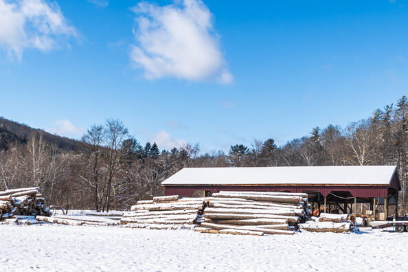
Many of America’s biggest cities grew because one powerful industry pulled everything else toward it. Steel plants attracted machine shops, auto factories attracted parts suppliers, film studios attracted editing houses, and financial centers attracted legal firms and consultants. Once that clustering begins, workers move in large numbers, housing expands quickly, and the city snowballs. In much of the northern interior, industries often centered on natural resources like timber, mining, or energy extraction, which created busy towns but not always diversified economic ecosystems that continuously expanded.
Resource towns can thrive strongly while production is high, yet they sometimes stabilize once operations become efficient rather than labor heavy. Without multiple industries expanding side by side, population growth usually spreads out instead of concentrating upward. Later companies looking for expansion sites typically chose existing industrial cities where trained labor and supply networks already existed. That decision kept reinforcing the same metro areas generation after generation. Northern regions stayed economically useful and productive, but fewer places developed the mixed corporate gravity that normally transforms busy towns into the kind of massive cities that dominate national population charts.
6. Building Costs Quietly Add Up
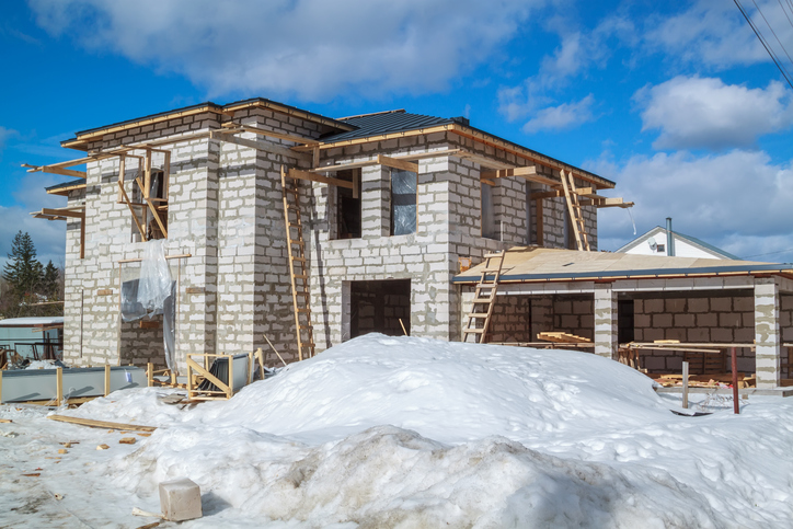
Constructing homes or commercial buildings in colder northern climates involves more than pouring concrete and raising walls. Foundations must handle freeze cycles, insulation standards need to be stronger, roofing must withstand heavy snow loads, and construction seasons can shorten when severe weather arrives early. Developers comparing multiple project sites often notice that the same building may cost more to complete and maintain in harsher climates over its lifetime. That difference does not always sound dramatic in conversation, yet on financial spreadsheets it can strongly influence investment decisions.
Housing developers, warehouse planners, and corporate expansion teams often follow the same practical logic. If a similar project can be completed faster and maintained cheaper somewhere with milder conditions, that option usually looks safer. Multiply that decision across thousands of construction projects over decades and the effect becomes visible on the population map. Northern land remains fully usable and often beautiful, yet large scale urban expansion historically faced slightly higher barriers. Those quiet cost differences, repeated year after year, gently nudged major development toward regions where building schedules felt longer, maintenance simpler, and long term operating risks easier to predict.
7. Protected Land Keeps Development Limited
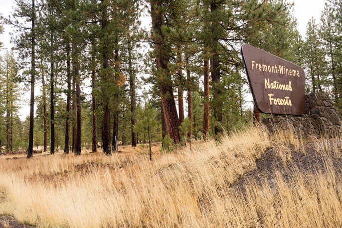
A surprising portion of northern territory appears lightly populated because large sections are intentionally preserved as national forests, protected watersheds, wildlife reserves, or federally managed land. These areas are not unused. They support recreation, conservation, timber management, and environmental protection that benefits the entire country. However, legal protections usually restrict dense urban construction, meaning nearby communities remain smaller even if economic activity continues around tourism or resource stewardship. When viewed on a population map, those preserved landscapes naturally register as low density zones.
Over time, this deliberate conservation approach shaped regional growth patterns. Instead of expanding suburbs endlessly into forest and watershed territory, planners maintained ecological buffers that protect rivers, wildlife corridors, and long term natural resources. Visitors may see busy campgrounds, hiking trails, and fishing towns during peak seasons, yet the permanent population numbers remain modest by design. The result is a northern landscape that feels wide and open not because development failed, but because large portions were consciously kept that way. Preservation decisions made decades ago still quietly influence how settlement spreads across those regions today.
8. Boomtown Cycles That Never Fully Stabilized
Several northern communities experienced sudden population surges when mining, timber harvesting, or energy projects expanded rapidly. Workers arrived, temporary housing filled, local shops thrived, and towns buzzed with activity. Yet resource economies often move in cycles. When production slows, automation increases, or market prices shift, employment demand can drop just as quickly. Many workers relocate to the next opportunity, leaving towns to stabilize at smaller long term population levels rather than continuing upward into large metropolitan growth.
This rise and settle pattern repeated across multiple northern regions over generations. Communities survived and often remained proud regional centers, but without continuous diversified employment streams, population spikes rarely transformed into permanent city scale expansion. Schools adjusted enrollment, housing markets cooled, and infrastructure remained sized for stable rather than explosive growth. The land kept producing valuable resources, yet workforce patterns stayed more rotational than permanently concentrated. That long economic rhythm helped leave behind a network of functional, hardworking towns scattered across vast spaces, reinforcing the impression of a huge northern landscape supporting industry while still maintaining relatively small permanent populations.
9. Fewer Giant Universities Drawing Crowds

One quiet factor many people overlook is how strongly large universities shape city growth. When a major campus expands, it does more than educate students. It pulls in research funding, teaching hospitals, graduate housing, technology startups, and service jobs that support thousands of daily routines. Over time, these academic ecosystems act like population engines. Students arrive from across the country, some stay after graduation, companies open nearby to recruit them, and whole neighborhoods grow around lecture halls and research centers. Many of the fastest growing American cities benefited from exactly this steady academic magnet effect.
In several northern interior regions, strong regional colleges exist, but fewer massive flagship campuses ever reached the scale that transforms an entire metro economy. Without that yearly cycle of tens of thousands of incoming students and research staff, population growth tends to move slower and remain locally rooted. Communities stay stable, educated, and productive, yet they receive fewer continuous migration waves. Over decades, that difference matters. Universities constantly refresh a workforce and attract outside investment, so where fewer mega campuses formed, fewer large population surges followed.
10. The Sunbelt Opportunity Pull

After the Second World War, millions of Americans began relocating toward southern and western states, chasing new jobs, affordable housing, and climates that felt easier year round. Air conditioning improved dramatically, highways opened long distance commuting, and industries like aerospace, logistics, entertainment, and technology expanded heavily in warmer regions. Families followed job offers, then extended relatives followed those families, and businesses opened wherever customers kept growing. Migration often behaves like that, once momentum starts it feeds itself naturally without needing any single dramatic push.
Northern regions did not suddenly empty out during this shift, but their growth slowed compared with booming Sunbelt metros. Over several decades, even slightly slower growth compounds into a huge demographic difference on census maps. What looks today like an underpopulated northern stretch often reflects the other side of explosive expansion somewhere else. Population distribution is rarely about one region failing. More often, it shows which region happened to accelerate at the exact historical moment when Americans were most mobile and industries were spreading across new suburban landscapes.
11. Essential Services Spread Farther Apart

When people choose where to settle long term, everyday services quietly influence the decision more than scenery alone. In many sparsely populated northern counties, hospitals, specialist clinics, large shopping centers, and major transport hubs may sit many miles apart. For young families thinking about schools, retirees thinking about healthcare access, or workers needing reliable daily logistics, that distance can shape relocation choices. Communities still provide dedicated services, but lower density naturally spreads those facilities across wider territory, making routine access require longer travel times.
Over years, even a small steady movement of residents toward areas with more concentrated services can gradually reshape demographics. It rarely looks dramatic at first. A few families relocate for medical convenience, a business chooses a town closer to a regional airport, a retiree moves nearer to specialized care. Yet across generations, those small practical shifts accumulate. Northern communities remain resilient and tightly connected, but fewer locations gather the dense infrastructure clusters that normally help towns expand into major metropolitan centers with the population scale seen elsewhere.
12. Broadband And Digital Timing Matters

In the modern economy, strong internet access can influence settlement almost as much as railroads once did. High speed broadband allows companies to operate remotely, students to attend virtual programs, and entrepreneurs to launch businesses without relocating. Some northern rural regions received widespread high speed infrastructure later than major urban corridors. During the early years of the online business boom, companies naturally clustered where connectivity already supported rapid growth and reliable digital operations. Once those tech ecosystems formed, they kept attracting investors, talent, and supporting industries.
Even after broadband coverage expanded significantly, population momentum tends to stay where industries already gathered. Workers often relocate toward established job networks rather than waiting for new ones to develop locally. The delay was never permanent isolation, but timing matters in economic growth. A region that connects slightly later may miss the earliest surge of startup expansion and corporate headquarters placement. Over decades, those timing differences quietly influence housing demand, office construction, and migration patterns, leaving some northern areas well connected today yet still carrying the demographic imprint of slower early digital adoption.
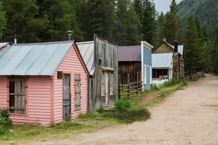
13. Tourism Became The Main Economic Rhythm
Many northern landscapes gradually became known less for industrial expansion and more for their natural beauty. Lakes, forests, wildlife areas, and mountain trails attract visitors looking for quiet weekends, fishing trips, hiking vacations, or seasonal cabins. Tourism economies can be strong and sustainable, yet they function differently from manufacturing or corporate headquarters hubs. Hotels, guide services, and vacation rentals support local employment, but they rarely require the dense permanent workforce that fuels major city growth. Seasonal visitors may flood an area in summer or holiday months while census numbers remain modest year round.
Over time, communities often leaned into that identity intentionally. Protecting shorelines, maintaining trail systems, and preserving scenic views became part of the long term economic strategy. Instead of building skyscrapers, towns invested in visitor facilities and environmental stewardship. That choice kept the region economically active while naturally limiting permanent population density. What looks like empty land on a demographic chart may actually be a thriving seasonal destination whose success depends precisely on staying spacious, calm, and visually unspoiled for the travelers who return every year.
14. Local Culture Prefers Smaller Communities

Population size is not always determined by economic limits alone. In some northern regions, residents genuinely value the stability and familiarity of smaller communities. Local planning boards may prioritize protecting open land, maintaining manageable traffic levels, and preserving long standing town character rather than encouraging rapid urban expansion. Families often appreciate knowing their neighbors, keeping school systems close knit, and staying connected to outdoor traditions tied to forests, lakes, and seasonal activities. These cultural preferences quietly shape zoning decisions, housing approvals, and development strategies over many decades.
From the outside, slower expansion can look like missed opportunity, yet from inside the community it often feels like intentional balance. Businesses still operate, schools still educate, and infrastructure still functions, but growth happens at a pace residents feel comfortable sustaining. Over generations, those shared values influence demographic outcomes just as strongly as climate or geography. The population map therefore reflects not only where growth could happen, but also where communities collectively chose to remain steady, preserving space and local identity rather than pursuing the density of large metropolitan life.
15. The Open Space Became Part Of The Appeal

When all these factors combine over centuries, the northern landscape begins to make sense in a very human way. Harsh winters, historic trade patterns, migration trends, infrastructure timing, industry placement, and local cultural choices all layered slowly together. None of them alone explains the population difference. Together they shaped a region where wide open land remained normal instead of temporary. For many residents and visitors today, that spaciousness is not seen as a drawback at all but as one of the area’s strongest qualities.
Some parts of a country naturally grow upward into dense skylines, financial districts, and crowded transit systems. Other parts grow outward into forests, lakes, and long quiet highways connecting smaller towns. The northern interior settled into that second rhythm, supporting resources, recreation, and communities that value breathing room over constant expansion. Seen this way, the map stops looking like a mystery and starts looking like a reflection of different lifestyles coexisting across one nation. If this breakdown helped you see the geography differently, share it with someone who loves simple map stories too.


